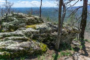
{{fig left img="2021-04-18_nantahala-highlands_chinquapin-mountain-trail-mossy-sides.jpg"}}
From the Glen Falls parking area, descends briefly to cross the East Fork Overflow Creek on a sturdy bridge, then begins ascending the valley of a lively...
Far from the side of any cliffs, this easy trail encircles the lake by that name. It passes through the campground and crosses over the dam and beach area.
This trail travels one mile through pine-hardwood forest and climbs to a ridgetop. Signs give trail descriptions along this trail, rated as more difficult.
This 1.5-mile trail follows the same path as the Clifftop Vista Nature Trail. At the ridgetop is a gazebo, the trail offers a panoramic mountain view. After the gazebo, this more-difficult trail continues along the ridge.
Three waterfalls along East Fork Creek are collectively known as Glen Falls, and are well worth the effort required to reach them. The trail travels downhill, starting at the back of the parking area. The trail emerges at the top of the first falls,...
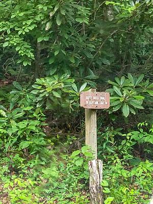
This easy 1.5-mile trail starts near Cliffside Lake Dam, follows Skitty Creek and connects with a road that meets U.S. 64 halfway between Dry and Bridal Veil Falls.
Climbs through some old homestead areas, past the loop to Ranger Falls, from the Cliffside Lake Recreation Area up to the old Highlands Ranger Station. Provides free parking access to the Cliffside Lake area.
Loop off of the Ranger Falls trail, providing access to both trails' namesake. Trail crosses right below this beautiful little 25' falls, and travels through an interesting area above and below it. Has some wet areas and rocks to climb over, but is...
This trail runs between from Cliffside Lake Road to a pull-off on US Hwy 64 about 0.4 mi west (north) of Dry Falls. The trail portion is 0.3 mi in length. Campers at the Van Hook Glade campground *could* combine the Van Hook trail (0.34 mi), with...
The Walton Interpretive Trail is named for Walton Smith, a resident in Cowee NC who led the charge against clearcut logging thorough the Western North Carolina Alliance's Forest Management Task Force from the late 70's through the early 90's. The...
A National Recreation Trail, this loop climbs an old roadbed and travels along the brink of some of the East's most spectacular cliffs. Named for these cliffs, the mountains side does look "white" from a distance with sun shining on the light gray...