Trails in the Graveyard Fields Trailhead Area

Here is a list of all trails in the Graveyard Fields Trailhead area.

Each trail has its own printable page with all the information and links, including (where available):

  • directions to the starting point
  • difficulty
  • length
  • elevation change
  • a map
  • photos from along the way, and
  • a detailed description and trail directions.

For general information about the Graveyard Fields trailhead, see the Graveyard Fields Trailhead page.

Need to find trails by another method? Go back to Trails.

Graveyard Fields Loop Trail

Moderate
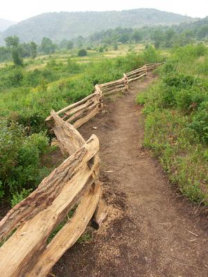
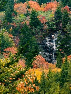
  • This loop travels through a unique, high-elevation, flat valley to a spectacular cascading waterfall. Braided streams, open valleys, short high-elevation forests, rhododendron & galax groves, clear pools. See Also the Graveryard Fields Best Hike.
  • 2.29mi, Some Hills, Some Obstacles

Graveyard Ridge Trail

Easy
  • Follows an old railroad grade through thin forests above Graveyard Fields valley. Mostly northern hardwood trees with a few spruces &/ firs near the intersection with the Mountains to Sea Trail. & the Ivestor Gap Trail. Rocky & wet in a...
  • 3.4mi, Level, Some Obstacles

Graveyard Ridge Connector Trail

Moderate
  • 0.38mi, Climbs Moderately, Moderately Rough

Mountains to Sea Access Trail

Easy
  • Connects the Second Falls spur of the Graveyard Fields trail to the Mountains to Sea Trail. Can be used to access the Skinny Dip Falls area from Graveyard Fields, or the other way around.
  • 0.23mi, Climbs Moderately, Some Obstacles

Upper Falls Trail

Moderate
  • mi, Climbs Moderately, Moderately Rough

Nearby Trails

The following trails cross into this trailhead area, but are primarily accessed from another trailhead:

Bridges Camp Gap Trail

Moderate
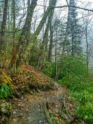
  • Starting on the Parkway in a mixed hardwood/spruce forest, the trail descends over a somewhat rocky path on an easy grade. You'll hear the river in the valley below. The trail passes through one switchback to the left and then into a wetter forest...
  • 1mi, Climbs Moderately, Moderately Rough
  • Blue Ridge Parkway Section 5 Trailhead

Mountains to Sea Section 2 Trail

Most Difficult
  • **Waterrock Knob to Pisgah Inn** From Waterrock Knob to Flat Gap, the trail follows the Blue Ridge Parkway closely at most times. It gains some distance from the motor road on the southwest slope of the ridge line from there to Haywood Gap. From...
  • 61.0mi, Hilly, Moderately Rough
  • Blue Ridge Parkway Section 6 Trailhead

Related Pages