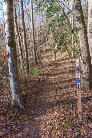
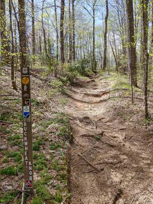
This is a National Recreation Trail and a Kids In Parks TRACK trail. It was constructed by the Youth Conservation Corps. The trail has several interpretive signs along the way which point out common plants, trees and animals which can be found in the...
Starting at the Davidson River Campground, the trail ascends Shut-in Ridge (not to be confused with the Shut-in Ridge near the French Broad River further north, where the long Shut-in Trail begins). It travels through Cat Gap, around the south side...
Starting in Gloucester Gap, this section of the Art Loeb trail winds its way up the ridge extending east from Pilot Mountain before crossing over the summit. It dips down into Deep Gap and Farlow Gap before resuming its climb, up Shuck Ridge, where...
Steep, rocky at northwest (upper) end. Passes through some logged areas. Passes a large waterfall, and through hemlock and rhododendron groves. Southeast end is a standard wet, creekside trail with log bridges. Can be used to make several looops in...
From it southern end at the junction with the Black Mountain trail, this trail descends Soapstone Ridge and reaches a junction with the Pink Beds Loop trail. It continues straight, passing through the center of the Pink Beds Valley. The valley...
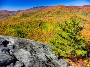
Starting at the top and going southeast, the trail climbs ever so slightly onto the wide, open ridge and passes through a wildlife opening. As the trail continues it descends, and the ridge gets narrower and narrower. There are some excellent,...
0.9 mi - Easy - This is a historic tour of the Biltmore Forest School, the first school of forestry in America. There are eight buildings along this paved trail, which helps depict the life of a forestry student in the early 1900’s. You will walk...
This heavily-used trail features incredible views, hiking along a needle-sharp ridgeline, and lots of rock outcroppings and boulders. The trail itself is notable (unfortunately) for its heavily eroded sections. Either through erosion or work to...
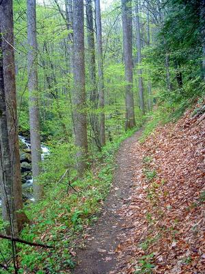
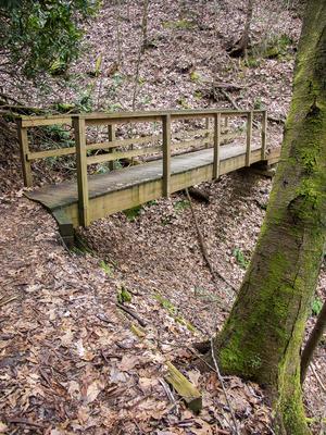
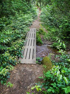
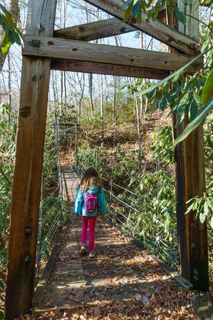
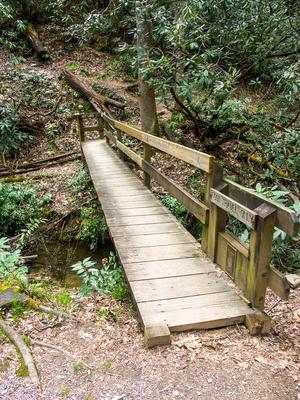
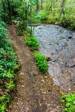
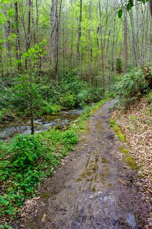
This fairly long trail has several creek crossings on its south end. These are completed via either log bridges or rock-hops and wades. The stream runs through a beautiful cove hardwood forest. There were formerly dense hemlock groves with some huge...
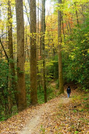
Travels first from the first switchback on US 276 above the Pink Beds to the Pisgah Inn. This is a gradual, pleasant climb that dips into coves & rounds the nose of many ridges with cove hardwoods in the coves and mixed hardwoods on the ridges. There...
Ridgeline trail. Passes some enormous trees. Steep climbs; rocky sections. Passes through pleasant areas with lush grass growing underneath large hardwood trees.
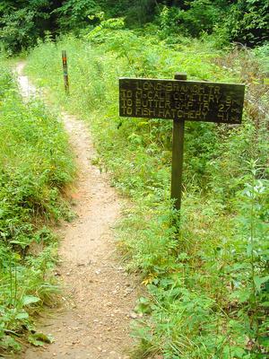
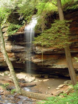
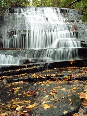
Scenic. Starts in Pickelsimer Fields; a flat, grassy area with crystal clear streams meandering through. Typical streamside trail further along. Trailside waterfall. Stiff climb up to Butter Gap; passes headwaters of the stream.
Travels from the Cove Creek trail at Cove Creek Group Campground up Caney Bottom Creek to reconnect with Cove Creek trail near the headwaters. Makes an excellent loop when combined with the Cove Creek trail. Passes several small to medium-sized...
Level or gradually climbing trail cuts through the upper end of the cove that gives rise to John Rock Branch. The trail swings into smaller head-coves & around low ridges. Passes mainly through a mixed hardwood forest with some hemlocks and...
Starts and ends at the Pisgah Center for Wildlife Education and Fish Hatchery. The loop can be hiked in either direction.
This trail circumnavigates John Rock, a granite pluton similar to its bigger brother just north (Looking Glass Rock). Most...
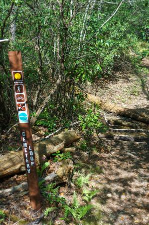
Follows an old road past an old cemetery on a little plateau near the Davidson River. Lots of white pines & hemlocks, & mountain laurel groves. Pleasant little loop.
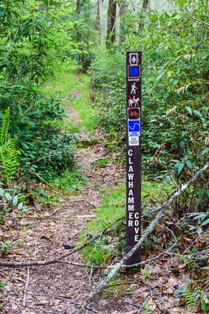
This is a pleasant hike that begins in a small meadow before climbing gently up Clawhammer Cove. There are some nice cascades that can be seen from the trail. Shortly after crossing the creek, the trail follows an old road up the shoulder of a ridge....
From FS 477/Avery Creek Road, climbs a bit through a shallow cove up and over the ridge, then descends into the next cove before resuming the climb up through that. The trail is muddy and wet in places and crosses small tributary branches. Turns...
Pleasant loop; you can take this one in either direction but my preference is clockwise. Nothing spectacular, just typical creekside, mountainside and ridgetop landscapes, but it is nicely varied. Loop travels up one cove and down another. Joins with...
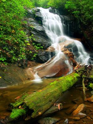
From Caney Bottom trail, climbs past Cove Creek Falls on an old road bed, through rich forests far above the stream, to flat areas near the headwaters and then up to Forest Service Road 225B. Unfortunately there is no good connector from the trail to...
Descends from the Cove Creek trail on a fairly steep course through a switchback to the bottom of Cove Creek Falls. Keep right at the side paths leading to the top of the falls; it's not safe to explore that area and the view is no good anyway. Keep...
The naming of this trail appears to be kind of a flub as it's not anywhere near Daniel Ridge itself; instead, the trail is on a spur of Lanning Ridge. Daniel Ridge is two mountains farther west. Described here clockwise, this trail can be hiked...
Follows old FR 475. The road has been re-routed further uphill now. Level or gentle climbs, gravel surface. Davidson River is in scenic small gorge below this road at this point. Several landslides in September of 2004 sent parts of this trail...
This new, easy trail follows the Davidson River up from the Lowe's in Brevard to the Davidson River Campground, connecting to the city of Brevard's greenway system. Easy, nearly level trail with some nice riverside scenery. Passes a large rock cliff...
Follows an old logging railroad grade from the start at the junction with Daniel Ridge trail in the Right Fork cove. From there, it passes a large sloping rock slab and then crosses Right Fork. This can be a tricky crossing to stay dry; it will be...
A network of paths through the forest south of
The Forest Festival Trail is open to the public during the Cradle of Forestry’s season, and guided walks are also available during this period. Annual schedules vary, so be sure to check at the...
This old, unmarked logging road (becoming more of a trail) connects the Art Loeb trail down to FS 471D, an old logging road, which leads on down to FS 471, Catheys Creek Road, opening up some loop possibilities.
An old road bed that is becoming a trail again. Moderate climb near the junction with Thrift Cove; levels out near the junction with Sycamore Cove. The open forest along the trail is filled with Appalachian Hill Cane in many areas.
Starting at the southwestern intersection with Cat Gap Loop trail, this trail starts is steep and rocky as it heads up over the first summit highpoint. Travels north over a wide ridgeline to the face of John Rock; there are 3 smaller summits to cross...
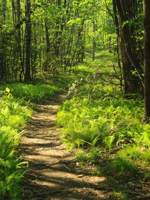
Trail passes through the interesting, relatively flat Long Branch valley near its western end and up and over some low ridges farther east. Some muddy sections near the west end have been reinforced with puncheon and/or rock & gravel causeways;...
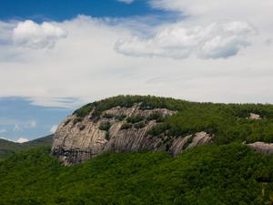
A classic Pisgah trail. Travels first through small cove, then steeply up the back side of Looking Glass Rock through many switchbacks. Mixed cove hardwood, hardwood, and pine-oak forests. Some areas of rare Carolina hemlocks. Rock slabs. End of...
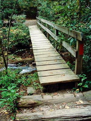
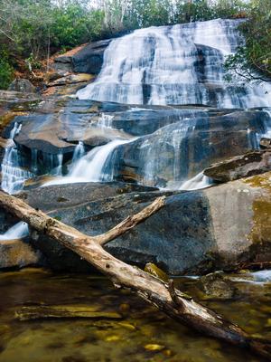
Travels beside a scenic stream to 70' free-falling Moore Cove Falls. Beautiful open cove hardwood forest with fern gardens. Several plank bridges & log causeways over wet areas. Rock outcroppings. This trail makes an excellent hike for families,...
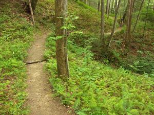
This neat little loop starts and ends in the Davidson River campground, making it a must-hike if you're staying there. Described counterclockwise, but can be hiked in either direction.
Starting at the campground's amphitheater, the trail climbs an...
An excellent loop which travels around the bottom of a unique valley. This is the "Cradle of Forestry in America", where modern forestry techniques were first developed, taught & practiced. Trail is mostly level with a few small hills on north...
Traveling through a nice cove, the trail climbs steeply along much of its length. It's in good shape for the most part. It crosses the stream twice on log bridges; the lower one is in bad condition so use caution. There are some small cascades when...
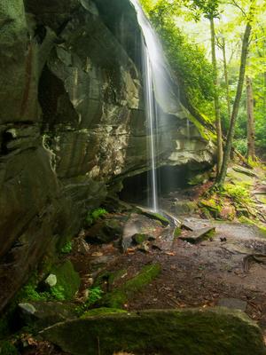
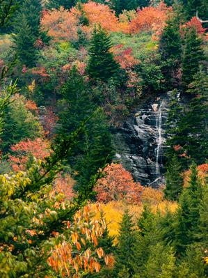
Provides access to the namesake waterfall after a very short distance on the trail. This segment is kid-friendly (it's very short). Continues uphill, past the falls, to the base of Looking Glass Rock; used mainly for climbing access. Stay away from...
Short, narrow connector from Black Mountain trail to Thrift Cove/Grassy Road trails. A few steps, but mostly a narrow, leaf-covered trail that climbs gently. From Thrift Cove down to Sycamore Cove, the trail is open to bikes, a bit steeper, and...
Travels up & down through coves near small streams; cove hardwood forests. In between, travels sidehill near the top of the ridge w/ a mixed hardwood forest.
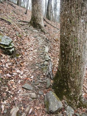
Long ridgeline trail which undulates up and down over the various knobs on its summit. Very steep in places; has some issues with erosion as well. It winds onto the edge of private land in places; stay on the trail. Travels through a typical...
**Waterrock Knob to Pisgah Inn**
From Waterrock Knob to Flat Gap, the trail follows the Blue Ridge Parkway closely at most times. It gains some distance from the motor road on the southwest slope of the ridge line from there to Haywood Gap.
From...


")