Craggy Pinnacle Hike
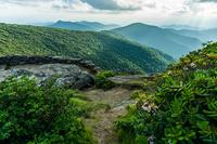
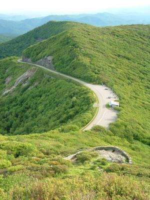
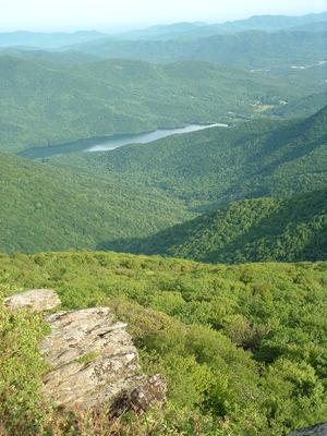
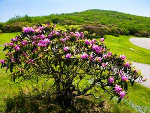
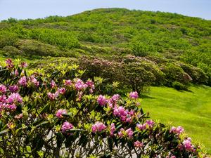
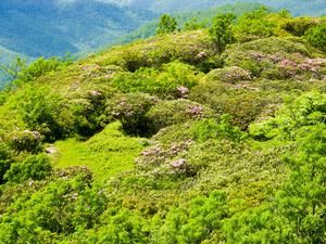
This popular trail climbs a short distance from a Blue Ridge Parkway overlook to a high, rocky peak with commanding views of the Craggy Gardens area. Blooming rhododendrons put on a fantastic display along this trail in late June. Twisted trees grow in the high-elevation Birch forest. Spectacular 360 degree views of the Visitor Center, the North Fork Reservoir, and the sourrounding mountains and valleys reward your climb.
At A Glance
 1.4 mi round-trip
Difficulty Rating: 1.98 ![]()
Tread Condition: Some Obstacles ![]()
Climb: Climbs Moderately ![]()
Lowest Elevation: 5660 ft
Highest Elevation: 5892 ft
Climb Total: 250 ft
Configuration: Out-and-back
Starting Point: Craggy Dome Overlook at Blue Ridge Parkway Milepost 364
Trails Used: Craggy Pinnacle
Hike Start Location
Directions
From Asheville, follow the Blue Ridge Parkway North 18 miles past the Folk Art Center. Pass the Craggy Gardens Picnic Area and Visitor Center; go under the Craggy Pinnacle tunnel. Turn left into the Craggy Dome overlook just past the tunnel. Park in the upper parking lot.
Details
Hike Description
Please note: While this trail remains open for now, the Blue Ridge Parkway General Management Plan / Final Environmental Impact Statement released on January 15, 2013 outlines a complete closure of this trail with a replacement trail to the top of nearby Craggy Dome as the Parkway's preferred alternative to managing this area.
Because funding will be needed in order to restore the trail when it is closed, it might be years before this actually happens, if at all. Until then, it is illegal to leave the established trail surface (for blueberry picking, selfies, bathroom breaks, or you know...any other purpose) by order of a Parkway Superintendent's Compendium issued in August of 2010.
By following this order to a "T", we can not only help protect the rare and endangered species on Craggy Pinnacle, but maybe play a role in convincing the Park Service to keep this trail open in the future. Because there is another alternative outlined in the master plan:
Retain the trail to Craggy Pinnacle. Explore and improve methods to keep visitors on the trail such as through signs, physical obstructions such as walls, staffing, and education. Monitor sensitive resources and adjust management actions as needed to meet protection needs.
While closure of the trail is what the Parkway master plan lists as the preferred alternative, the option to keep it open it is still officially on the books. So by proving we can stay on the trail, hikers actions now could be instrumental in the future of Craggy Pinnacle!
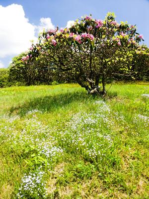
This short, moderately steep trial takes you to one of the best 360 degree summit views on the Blue Ridge Parkway! Traveling through a stunted high-elevation forest of mostly birch trees, you can explore the second-highest Southern Appalachian forest community and another unique environment as well: a high-elevation heath bald. During the early summer, enjoy the beautiful pink and purple blooms of the Catawba rhododendron which cover this "bald". The trail climbs moderately, but is very short, and there are plenty of recommended resting points along the way, making the hike easy overall.
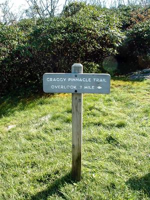
Starting in the parking lot at an elevation of 5640', climb the short set of steps to a a pleasant grassy area, with a couple of sign boards explaining the phenomenon of the heath bald. A nice view of the North Fork reservoir is to your left, and behind the board some very nice, large rhododendrons grow. As the trail sign indicates, you start the hike on the trail to the right.
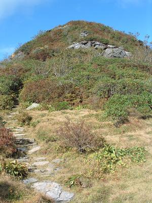
Old rhododendrons arch over the trail at first, and then give way to trees. In a heath bald, shrubs such as rhododendron, mountain laurel, and blueberry cover the hillside instead of trees. Most of this trail used to travel through such a bald; however, a high-elevation northern hardwood forest is rapidly encroaching on it. Many of the heaths which grow here are very old and past their prime; more than a few are already dead. They look their best when disturbed or "pruned back" every so often, such as by wildfire or grazing by animals - but this isn't happening as much anymore since the area is under Blue Ridge Parkway protection. The trees consists mostly of birch and mountain ash, and some maples as well.
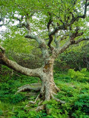
The trail is well-worn and easy to follow, but a few sections are rocky and have log water turnouts. The trees are extremely stunted, attesting to the high winds and cold temperatures that commonly occur at this high elevation. You'll pass three points of interest along this section of the trail. The first is a short, gnarled birch tree above the trail on the left. This tree is probably very old, but never reached a large size due to the mountains' exposure. The trail gets a bit steeper here.
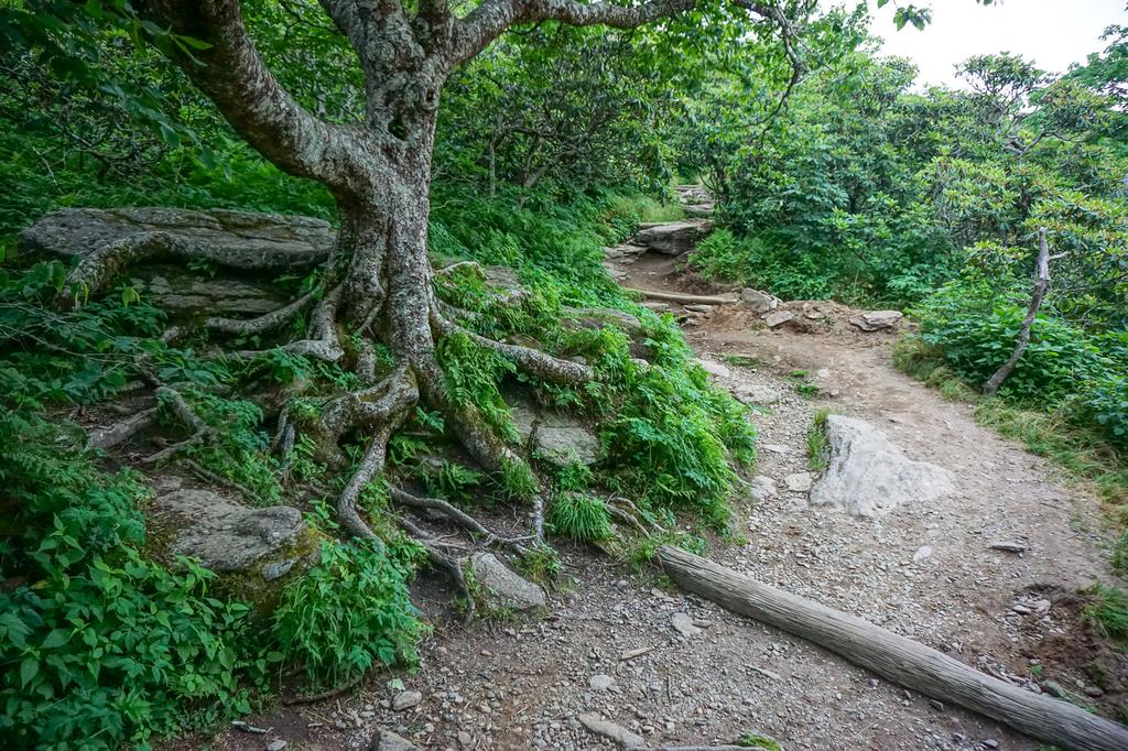
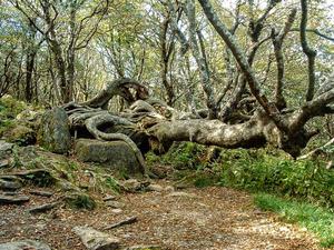
Then there is another neat birch tree - this time on your right. This tree lies parallel to the ground and probably fell many years ago during strong winds. But it still lives, and is quite big around!
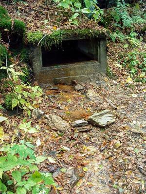
Its twisted roots, arching up from the rocky ground, make a favorite spot for kids to play while parents rest, and are visually striking enough to ensure that you can't miss it. Its branches reach straight up into the wind to form a canopy scarcely 20 to 30 feet above the ground. On the left side of the trail, just up from this tree, is a crystal-clear, trickling spring partly enclosed by a concrete box. This is actually the headwaters for Waterfall Creek, a tributary of which plunges over the beautiful Douglas Falls somewhat lower down the mountain.
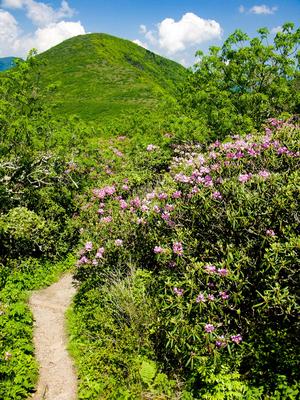
Shortly past the spring, the rhododendrons return in force and the trail makes a switchback around a large boulder - the third point of interest mentioned before. There's a small cave under the rock, and a great view from on top of it. A sign here pleads with you to stay on the trail; heed that warning, as you are entering a sensitive habitat with fragile, endangered species (and since it's the law, you might get a ticket if you don't). You'll continue climbing, back into a heath bald with rhododendron, mountain laurel, and blueberry bushes.
Some short side paths lead to great blueberry patches, but it's not always clear which ones are sanctioned by the Park Service, so it's best to just stick to the main path and get any blueberries within reach. (Better off-trail wandering for blueberries can be found one mountain south, on the Craggy Gardens hike).
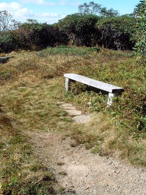
You'll reach the crest of the ridge where a nice resting bench has been placed. Behind the bench is an open, grassy meadow, and behind that are blueberry thickets - but again, going that way could be considered leaving the trail in violation of the supervisor's order, so stick to the area around the bench. Just past the bench is a split in the trail; left is the summit overlook and right is the lower overlook. Start by going left to reach the summit.
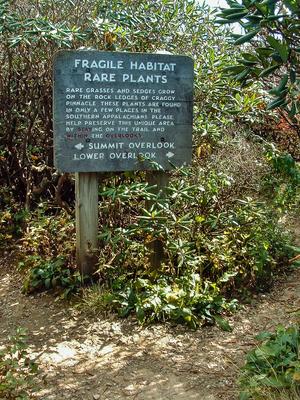
The trail climbs just a few more feet from the split up to the summit, up some rock and log steps. The overlook is well marked by rock walls. Another sign there has information about the summit and the surrounding area, and there are some benches to rest on. As the sign board back at the split implores you: please, stay within the designated overlooks!
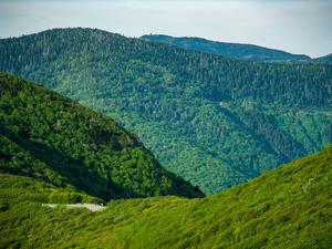
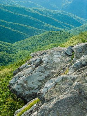
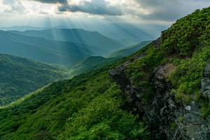
From the summit, you have a spectacular 360 degree view of the surrounding mountains. To your north (back toward the parking lot), you can see Craggy Dome and the Black Mountains - including Mount Mitchell, the highest peak east of the Mississippi. To your west, you'll see the Dillingham valley and mountains in nearby Madison County, including the State Line Ridge. Unfortunately, you'll also see the new Interstate 26 climbing said ridge. To the south, you can see the Craggy Gardens visitor center, the trail shelter on Craggy Flats, and the Blue Ridge Parkway snaking around Lane Pinnacle towards Asheville.
You can see Asheville's outskirts on a clear day - namely the Asheville Mall and Tunnel Road businesses - but downtown is hidden behind the ridges. Beyond Asheville lies Mount Pisgah and the Pisgah range. To the southwest you may be able to make out the Great Smoky Mountains on a very clear day. And finally, to the east, is the North Fork reservoir - Asheville's water source - and Graybeard Mountain.

You may wish to descend to the lower overlook. Go back to the split, and turn left. It's a few yards on a descending path to the overlook area in a grassy bald. Look back up toward the summit and the surrounding boulders.
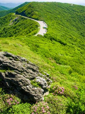
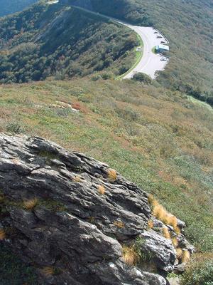
You will probably see sedges - tufts of grasslike plants growing in the cracks, which look like big, blonde wigs waving in the wind. This is an example of the kind of vegetation that is being protected by the trail restrictions and potential trail closures. People who leave the trail often don't recognize this special vegetation and trample on it, killing some of the only remaining specimens of its kind in the world.
The rocky, pointed knob of Craggy Pinnacle harbors some of the most sensitive plant habitats in the Southern Appalachian Mountain region. These plants are a relic of the alpine tundra environment that existed across much of the southern Appalachians during the last Ice Age. As the earth warmed and the cold-loving plants retreated north, they also retreated up in elevation - and take refuge only on the highest peaks such as this one. And as they become isolated by the valleys separating the peaks, these plants evolve into new endemic species that grow nowhere else on earth!
You may also see some of these sedges growing on the large boulder in the foreground as you look back down toward the visitor center. A trail used to climb straight up to this overlook from the visitor center, but it has long been closed to protect the sensitive environment.
When you're done soaking up the views, return to your vehicle via the same trail.
All Photos from This Hike
Map
Green highlight indicates the route to follow within the trail network for this hike.
Tip: Printing this map? You can pan and zoom the map as desired before printing to show the area you need.
Map Information
Download GPS Data
Click on a route, trail, or point on the map and select the GPS Data tab to download its data.
Data Formats
KML (Google Earth)
KML is the main file type used by Google Earth. If you have Google Earth installed, clicking the KML link should open the trail or point directly in Google Earth for viewing. This is the native file format used by Google Earth, but many other map applications can use and understand KML as well, so if you're not sure which one to download, KML is a good bet.
GPX
The GPX format stands for GPS Exchange - a free, open, XML format for exchanging GPS and map data. GPX is compatible with Google Earth, many other mapping programs, and most GPS devices (such as Garmin). Load the file directly into your GPS to help find your way on your next trip!
GeoJSON
GeoJSON is a newer, lightweight data exchange format which can be used to quickly share map data and may have a smaller size than KML or GPX. Many professional mapping and GIS applications support the GeoJSON format.
About the Map
Copyright
Base Layers
Base layers provided by OpenStreetMap, the US Geological Survey, the US Forest Service, and NC OneMap. Base layer images are subject to the respective copyright policies of their owners. Base layers may not be available at all times due to system maintenance or outages.
WNCOutdoors Base Layer
The WNCOutdoors Base layer is provided by WNCOutdoors.info. It is licensed by Creative Commons Attribution 3.0.
Trail and Marker Overlays
Trail layers and downloadable data are all original works created by WNCOutdoors with guidance from a variety of sources, including ensembles of our own GPS tracks, user contributed GPS tracks, official maps and GIS data from government agencies, and field observations. WNCOutdoors data is made freely available under the Open Database License - you are free to copy and use it for any purpose under the terms of that license (summary).
Tips
- Hover over a trail to see it highlighted. Helps to see start and end points for an individual trail.
- Scroll and zoom the map before printing, and that view will persist into the printed image.
- Click a trail for more details and to download it individually.
Feedback
Ratings
Average Rating: 3.8 (rated 5 times)
Rate It Now:





Oz Geier said: Breathtaking vista. Well worth the stop.
Jennifer said: Hi! I am wondering if this hike is doable for someone who isn't in great shape? I was hoping that if I just took it slow, it would be ok. Thanks for any advice!
Leah said: I'm confused - Can you confirm if this trail is open to the public right now or not? Thanks!
Austin said: Best panoramic view for the shortest drive and fairly easy hike (though there is some climbing and a few rough spots) anywhere around Asheville. A couple of times we have gone up there, bears crossed in front of our car on the Parkway before and after the Craggy Picnic area entrance midi-morning. From the Pinnacle you can see Mt Mitchell and tell whether it is worth the drive further or if Mt Mitchell area is too overcast in the clouds!
John Huggins said: The climb takes some effort but is easily manageable for moderately fit individuals. After a little "huffing and puffing" on the way up, the climber will find the spectacular panoramic view from the top is well worth the effort. The trail is somewhat rough, with some rocks and minor obstacles, so walking carefully is mandatory. Driving from Asheville, the entrance to the parking area at the base is a little difficult to see.