Maps of the Graveyard Fields Area
Several maps are available of this popular section of the Pisgah National Forest. All these maps are made by 3rd parties except our GPS map, but come recommended for use and are available at most outdoor retailers in the area. Be sure to order one online or pick one up at a retailer before you get to the trailhead!

Our Interactive GPS Map
This is our interactive GPS map of the area with downloadable data. This map shows all the official Forest Service trails, locations of the waterfalls, parking, and other landmarks. Transfer the data to your computer for viewing in Google Earth, a GIS system, or your GPS device while on the trail!
Western North Carolina Trail Guide by Pisgah Map Company
The newest addition to the lineup of maps for this area is this foldable waterproof map. Produced locally, the map makers are trail users themselves and so bring local knowledge and experience to their product. This map shows all the trails in this area with somewhat more detail than the Trails Illustrated series maps, making it the most highly recommended option for a commercial paper map.
National Geographic Trails Illustrated #780: Pisgah Ranger District
<
p>This has been the standard trail map for the area for many years. All trails in the area are shown - although the scale is a little coarse it is sufficient for general navigation.
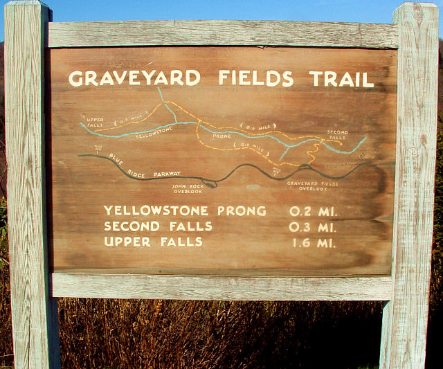
Image of the Trailhead Map
This carved wooden map is located at the Blue Ridge Parkway trailhead overlook. It's kind of coarse, but it looks neat and gives an overview of the trails in the area to casual hikers.